For many, the most familiar maps are the ones that delineate the borders of nations and territories, showing cities, bodies of water, and other details. For many others, map apps on smart phones get us from point A to B on a regular basis. Then there is Rebecca Solit’s thematically based San Francisco atlas, Infinite City, which reminds us that maps can also represent fascinating aspects of a city’s history.
Topographic maps provide a particular kind of information that is widely used by hikers or other outdoors enthusiasts. Topography is also an important area for the engineering design technology professional. The skill of drawing and reading topographic maps is integral to your education, preparing you for work within engineering firms, construction businesses, and many other places. Read more to find out how topographic maps connect to your career.
What Is a “Topo” Map?
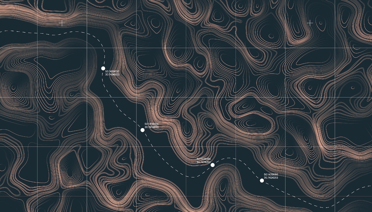
Topographic maps, sometimes referred to as “topo” maps, are representations of a geographical area that includes natural and human-made elements. What is specific about topo maps is that they indicate the elevation and depression of a surface using contour lines. Topographic information is also sometimes represented through colour schemes.
Topographic maps are especially important for gathering surveying data as well as for road design. In fact, these are two of the applications you may encounter during an engineering design technology program. Roads are built through all kinds of terrain. For example, Hana Highway in Maui would have relied on topo mapping information to support the design of 600 curves and 54 bridges within an eighty-three kilometre stretch.
How to Read a Topographical Map
Although topographic models may be a possible topic in BIM courses, topographic maps traditionally use contour lines in a 2D environment to indicate the incline of a terrain. Contour lines connect points that have the same elevation. These lines also trace the shapes of things like hills so the maps look like sets of irregularly shaped concentric circles.
Importantly, contour lines never intersect. The lines are drawn according to the contour interval. For example, a contour line may be drawn for every 20 metres of elevation. Many lines close together indicate a steep slope, while lines that are father apart indicate a more gradual elevation. Like other maps, topo maps will also include indications of scale, colour coding for various elements, icons for different features, and orientation in relation to North.

Like other engineering related projects, topographical mapping will involve teamwork
Where Your Career in Engineering Design Technology Intersects with the Dalton Highway
As suggested earlier, your career in engineering design technology may include involvement with road design. Some of the issues that must be taken into consideration at various stages of road design include minimizing environmental impacts, the plots of the vertical profile of the roadway, drainage requirements, and guidelines or codes for geometric design.
These elements may be understood through the example of the Dalton Highway. This road has run parallel to the trans-Alaskan since the 1970’s and is mostly unpaved. The environmental conditions made gravel a more idea surface to avoid excess potholes, and to make driving in inclement weather safer. The principles you learn in a topographic drawing course will be part of how you transform your passion into exciting projects.
Ready to make an investment in your future?
Your career awaits.